


Historical Overview of Monroe County Kentucky In 2017 - Philip Thomason
Department of Library Special Collections - Western Kentucky University

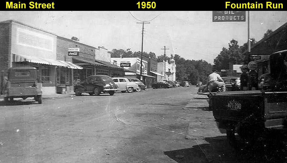
Monroe County Kentucky (population 11,200) is located in the south central portion of the state alongside the Kentucky-Tennessee border. It is part of what is known as the Pennyrile (Pennyroyal) region an area named for the native medicinal plant, and situated between the Central Lowlands of the Midwest and Appalachian Plateau. Monroe County’s hilly topography is heavy with limestone and shale deposits, and the soil ranges from medium to low in fertility. The Cumberland River is the county’s major waterway and winds through the eastern portion of the county, while the Barren River lies in its southwestern section. Monroe County is largely rural in name with agriculture as the historically dominant economic base. Manufacturing concerns are limited and currently employ approximately 2,000 people. Wholesale and retail trades hire around 700 workers. Tompkinsville which is centrally located in the county serves as the county seat and is the county’s largest town with a population of approximately 2,800 residents. A number of small communities dot the rural landscape of Monroe County and include Gamaliel, Fountain Run, Mud Lick, Sulphur Lick, Persimmon, Meshack, Flippin, and Hestand.
The land that currently makes up Monroe County was originally hunting grounds for various Native American tribes. In 1769 Daniel Boone and other frontiersmen explored Kentucky and a move toward white settlement soon followed. After the defeat of the Shawnee in the Ohio Valley in 1774 and subsequent treaties with the Cherokee, lands south of the Ohio River became open to settlers. In January 1775, Judge Richard Henderson of North Carolina formed the Transylvania Land Company and hired Daniel Boone and others to clear a passage to provide access to the land. This Wilderness Road was a primitive path but still provided a route to the west. The disruption of the Revolutionary War initially stalled settlement in Kentucky, but in the 1780s, pioneers began to arrive. Central Kentucky with its rich farmland was the destination of the majority of newcomers. At this time, the region was part of the State of Virginia, and that portion south of the Green River became reserved for Virginia’s Revolutionary War veterans, thus non-veterans had little chance to acquire the lands.
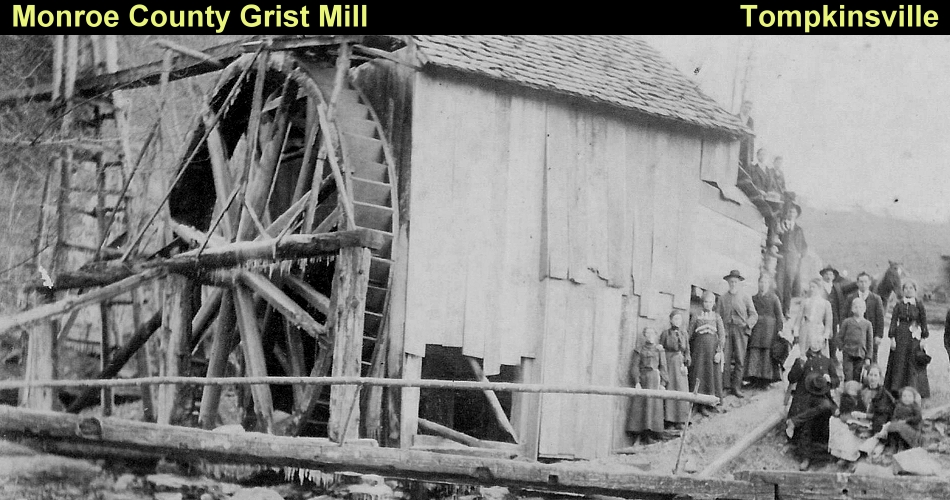
Settlement in what became Monroe County began in the late 1780s and was slow to develop. The land was not fertile as in surrounding areas and many pioneers chose to pass through the area and continue westward. Those who decided to homestead in the area primarily came from Virginia, East Tennessee, and North Carolina and were of English, Scotch-Irish, German, and French ancestry. The earliest permanent settlements we by 1790. These were in Fountain Run and Flippin in the western portion of the county, Meshack Creek near the eastern border, and centrally located Tompkinsville. In 1787 Thomas Flippin left his East Tennessee home to explore the southern Kentucky region. He returned with his family in 1790 to settle permanently near Indian Creek. The village known as Pikeville for many years eventually became Flippin after its founder. Around this same time, several families including those of Moses Kirkpatrick and John C. Belford settled along the Cumberland River in the Center Point and Meshack areas. Upon arriving in the area Moses Kirkpatrick (1763-1835) erected a log dwelling for his family. He became a successful farmer and miller, and he also initiated trade in the region by establishing the first home market and individual flat boating business. He purchased surplus from other farmers, built his own flatboats, and floated a substantial quantity of goods to the market in New Orleans. Kirkpatrick’s success reflected the expansion of his home. When he considered a brick wing, which doubled the size of the original log structure. Brick dwellings were rare in Monroe County during this period due to their high cost.
The Moses Kirkpatrick House remains extant today. However, it has undergone significant alterations such as the addition of aluminum siding, concrete porches, and replacement windows. Another two-story brick dwelling lived alongside the house. This dwelling was also associated with the Kirkpatrick family and probably owned by Moses’s son William Kirkpatrick (1785-1883). Fire consumed the dwelling and only portions of exterior walls remain. What is now Gamaliel began to form in 1798 when James Crawford and John Hays settled at the head of Line Creek. The Welch family also settled early on in this area. Around 1836, Hays and Crawford donated ten acres to the community for educational and religious purposes. By 1840 a log structure served as both a school and church. This building has been replaced several times after being destroyed by fire. Several other small communities throughout the county such as Mt Gilead and Sulphur Lick also got their start between 1795 and 1810. On June 1st, 1792, the State of Kentucky was formed and in 1797 the state legislature ruled that lands south of the Green River which were once reserved for Virginia veterans were open for purchase to anyone. The land was underpriced and settlers flocked to the southern Kentucky region. Monroe County was formed January 19th, 1820 out of portions of Barren and Cumberland Counties and named in honor of President James Monroe. Residents chose a central location in the county to serve as the county seat and named it Tompkinsville after Vice President Daniel Tompkins. Boundaries of the county fluctuated in the early 1800s became fixed to the present borders by 1860.
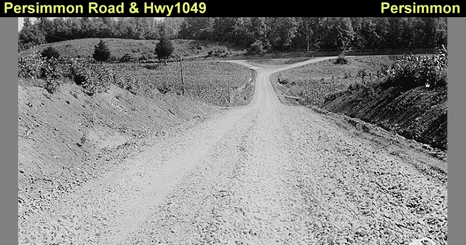
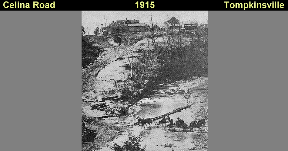
As the area attracted more settlers, distinct travel routes emerged. Old Trace Road in the eastern portion of the county was one of the first passageways initiated. Early settler Moses Kirkpatrick allegedly discovered the route which travels northwest from Black’s Ferry through the communities of Meshack and Pleasant Hill and leads into Metcalfe County. Originally known as Kirkpatrick’s Trace the route became mainstream by 1801. In western Monroe County, the Pikeville or Flippin Road served a similar purpose and traversed northeast from the Kentucky-Tennessee state line through Flippin and then Sulphur Lake before reaching Metcalfe County. Rapid road construction took place throughout Monroe County in the years following the War of 1812 establishing connections between the fledgling communities. Though little more than paths these roads served as avenues of transportation, communication, and access to markets. River travel also provided a link other areas with keel or flat boats used to transport people and goods to southern destinations. The Cumberland River in the eastern portion of the county was particularly important in the exchange of goods and the transport of agricultural products to markets.
Throughout the 1800s Monroe County’s economy was heavily based on agriculture. Industry was minimal, though sawmills, grain mills, tan yards, and wagon makers were common among settlements, as well as distilleries for whiskey. But agriculture remained the dominant sector. Among the crops most harvested were wheat, rye, oats, peas, beans, potatoes, and tobacco. The most fertile lands were those near the Cumberland River area, which served as the center of the county’s agriculture. However the majority of the county’s land was not as fertile as its northern and eastern neighbors, thus agriculture only provided a limited source of income for Monroe County’s citizens despite being the primary source. One of the most important crops to early settlers was corn due to its many uses and its adaptability to various terrains and soil. Corn produced foods such as hominy, mush, hoecakes, and bread, distilled into whiskey, used as livestock feed, and could be equally grown in hills and flatlands. As areas were cleared of woodlands, rather than burning and removing the stumps of trees settlers planted corn directly around them. After eating the fruit of the plant the cobs were burned and the stalks used to feed livestock. Small family farms cultivated approximately twenty acres of corn annually. The twenty bushels harvested supplied the family and its livestock. The poorer a soil the more a farm depended on corn.
Hemp was another important crop, useful in making rope, twine, and bagging. The rise of the cotton industry, which required hemp bags and twine, accelerated its growth in Monroe County. Rope and twine were also greatly used by naval ships. By 1840 Kentucky was the leading producer of hemp in the U.S. and its value was so high, merchants substituted the product for cash in many parts of the state. By century’s end the market for hemp had faded. Three major factors contributed to this downfall: superior fibers created intense competition; steamboats, which had no use for hemp in rigging, gradually replaced sailing ships; and slavery’s end following the Civil War eliminated the free labor vital for production of hemp and cotton. Livestock was also essential to Monroe County farms. Horses and mules were used for labor, and cows, hogs, goats, and sheep were commonly found on most farms. Livestock provided meat for family consumption, but it also was a key market product. The rocky terrain and often less than average soil of Monroe County limited its agricultural potential, and livestock, particularly hogs, became a significant export trade. Livestock required less cost and maintenance than crops depended less on weather and soil conditions and were more easily transported to market. Hogs were much preferred over cattle because hogs did not require the careful breeding that beef did. Hogs also could feed themselves on mast or be fed from the dried corn stored for such purpose. During the mid-19th century the Pennyrile region of Kentucky was one of the principal hog producing areas in the country raising forty-four percent of the state’s swine. Hogs were driven to markets in the east, and salted pork was sent down river to markets in the south, where farms produced cotton exclusively rather than devoting some acreage to the production of food products.
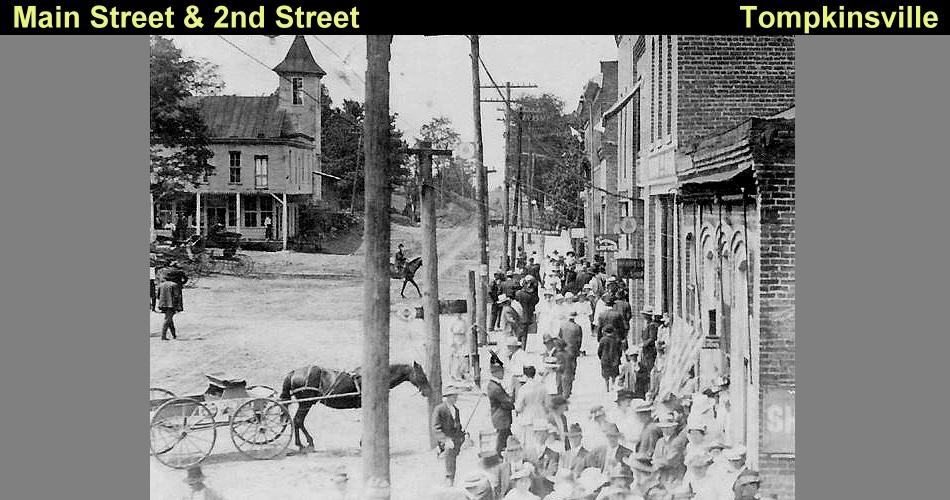
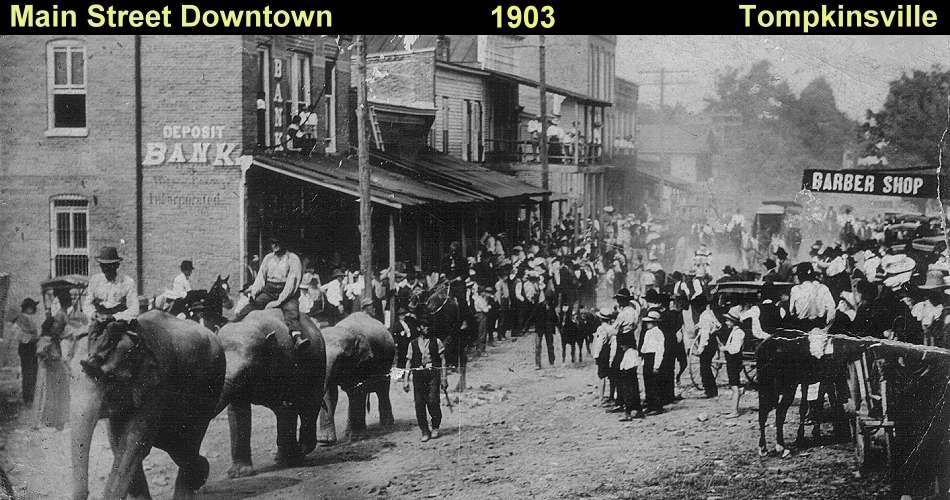
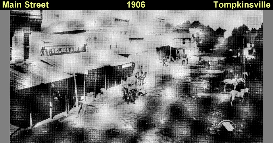
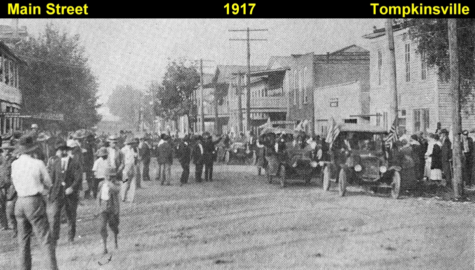
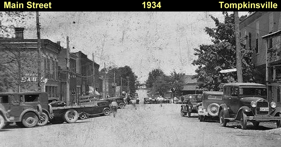
A variety of outbuildings were commonly erected on Monroe County farms to support their agricultural activities. Assorted barns were used to store hay, livestock, and equipment. Due to the area’s heavy corn production, corn cribs were numerous with at least one on every farm. Early cribs were constructed of unchincked logs covered by a gabled roof with adequate overhang to rain off the walls. The soil in Monroe County was not as suitable for tobacco as that in surrounding counties although the crop was grown to some extent. For those farms that raised tobacco, tobacco barns for drying the leaves were part of the landscape. Smokehouses for preserving meat were also common structures on 19th century Monroe County farms. A chinked log construction provided a tight seal to keep the smoke in and pests out. As it became available, milled lumber replaced logs. Spring houses were found on farms with a nearby water source. These small outbuildings were constructed over the stream which allowed the water to cool perishables such as dairy products. By 1790 the area that developed into Tompkinsville was home to around eight farms. The second largest community in the area the settlement was primarily a subsistence farming community with a blacksmith as the only business. Settlers travelled to Glasgow for supplies until 1809 when JC Watson opened the area’s first store. The village eventually grew into a proper town due to the encouragement of the Mars family. Through his service in the War of 1812, local resident Abijah Mars visited several small towns and returned home with the idea of developing a similar design.
He encouraged his father Samuel to donate a portion of his property to the community and Abijah laid out a network of streets. In 1817 the town was incorporated. Several churches were established throughout the area during the early 1800s. Many were affiliated with the Baptist faith and various local and regional associations developed. One of the earliest churches established in Monroe County was the Mill Creek Church built along that stream southeast of Tompkinsville in the late 1700s. Founded by travelling preacher Jonathan Mulkey the church became commonly known as the Mulkey Church or Meeting House. A new meeting house was built in 1804 to replace the original log church. The building which remains standing today was constructed in the shape of a cross with twelve corners to represent the twelve apostles. The congregation split in 1809 with Mulkey’s followers remaining at the Mill Creek site. By 1856 the building had fallen into disuse and was abandoned. Efforts to restore it in 1890 resulted in weekly meetings until 1910 when it fell again into disuse. A second effort to save the building arose in 1925 which by that point the building had lost its roof, doors, and windows. In November 1931 the Old Mulkey Meeting House and associated cemetery were both designated a state park and in 1973, it was placed on the National Register of Historic Places.
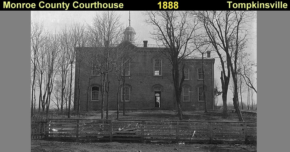
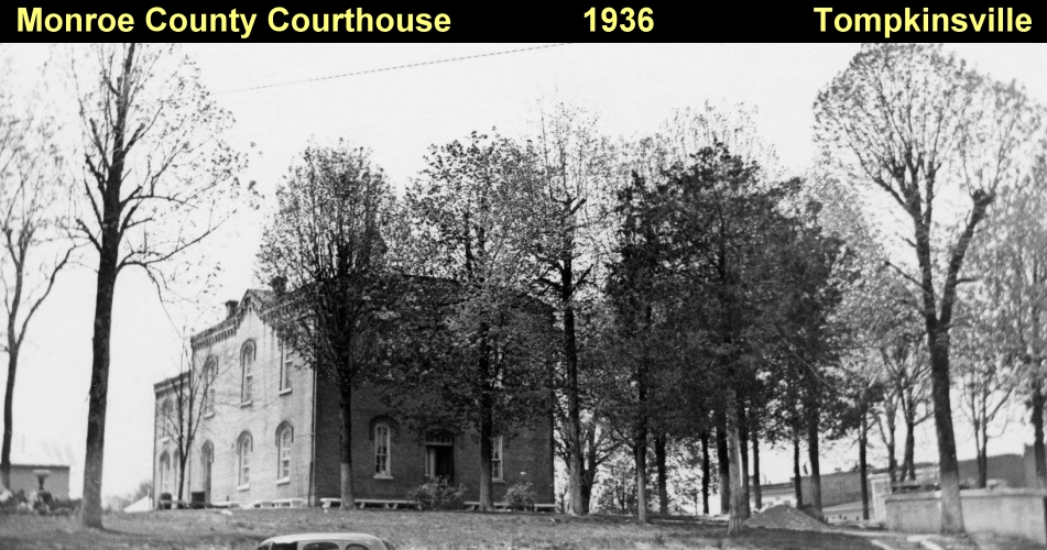
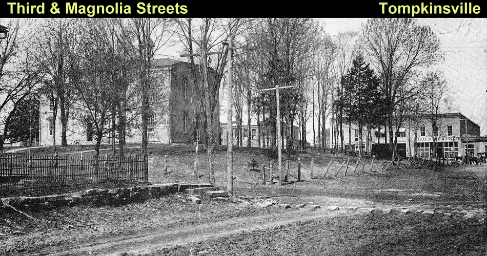
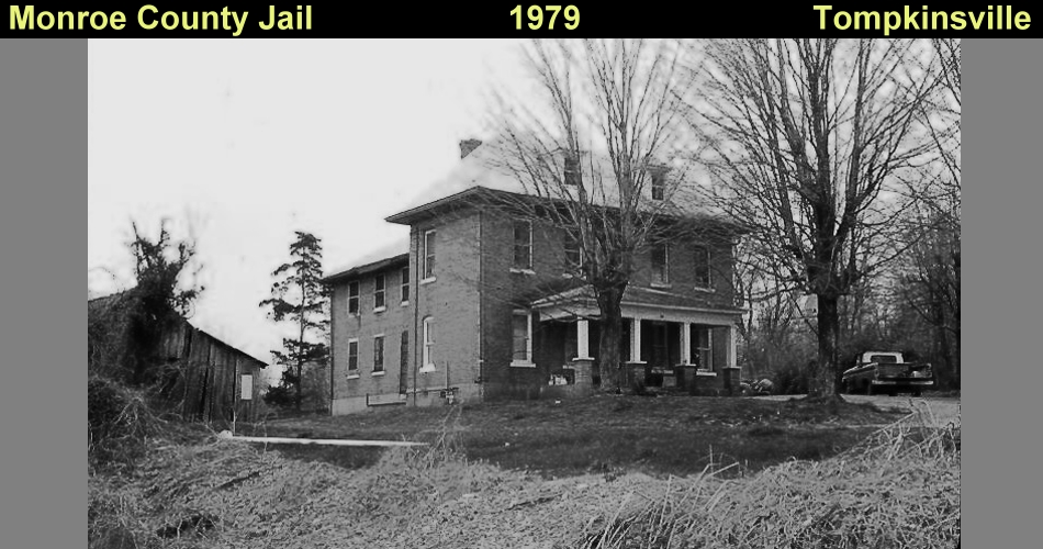
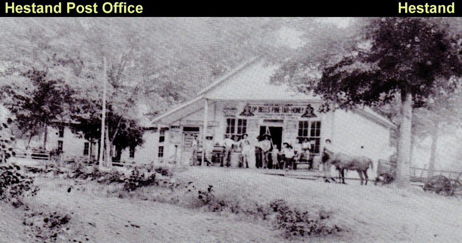
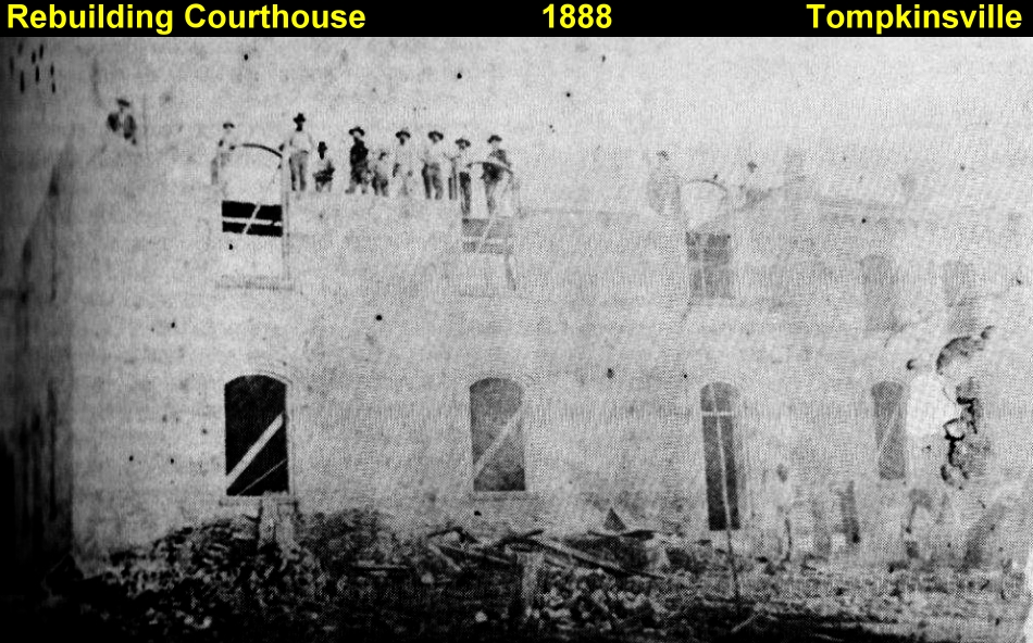
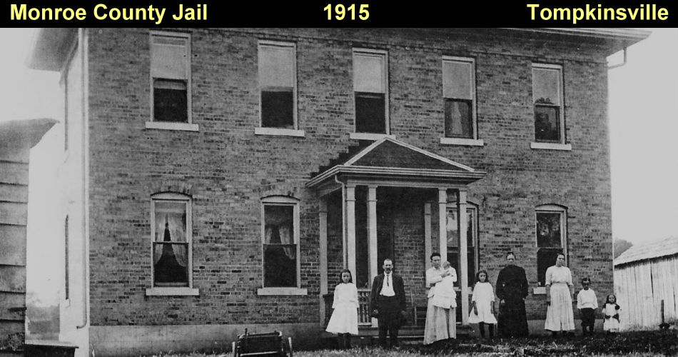
Monroe County had its first courthouse in Tompkinsville in 1823, the first brick and stone building in the county. Confederate troops burnt the original building down in 1863. After the Civil War in 1865 an identical courthouse replaced the skeletal remains. Fire also destroyed this building. The courthouse was completed in 1889. This third building remains as the county judicial center. At the time of its 1817 incorporation, Tompkinsville had a population of approximately 100. By 1830 that number had doubled to 200. Postal service in Tompkinsville was established in 1819. Later on postal service was initiated in Center Point in 1835, Fountain Run in 1847, and Sulphur Lick in 1850. Flippin received postal service in 1858, as did Gamaliel in 1870. Early postal offices started in resident homes and later were relocated to general stores. By 1889 a stagecoach line from Tompkinsville to Glasgow aided transportation and communication. The coach made three round trips each week between the two communities. The community of Hestand established its first post office in 1888 and located it in a small log cabin behind a general store and then later moved to an old water mill on the Barlow Baxter farm. In 1904 Barlow Baxter was appointed postmaster. A new general store was erected at this time across the street from the Baxter residence and the post office was housed there. The position of Hestand postmaster remained in the Baxter family over 100 years and the 1904 structure remains intact and continues to serve as the community’s post office.
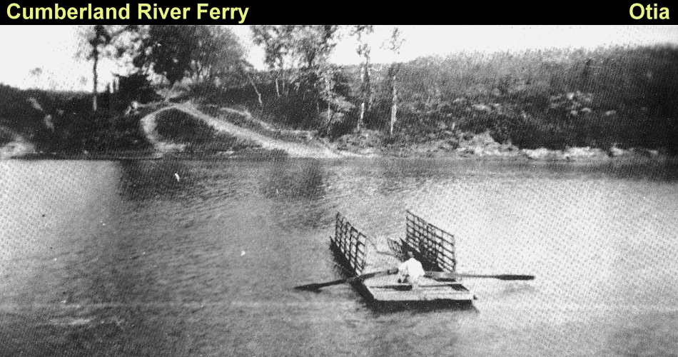
River transportation remained crucial to Monroe County’s economic development helped by the steamboat. Use of the large steam powered vessels began in the 1830s and was well established by the 1840s. Faster more reliable and more versatile than previous transportation methods the steamboat allowed large quantities of livestock, tobacco, and other products shipped to a greater number of outside markets. One of the first steamboat landings in Monroe County was McMillan’s Landing in the Turkey Neck Bend area of the Cumberland River. Other prominent landings were situated at Black’s Ferry and Martinsburg. Around 1880 Clark C Fowler, a local merchant and postmaster constructed a two-story dwelling facing the Cumberland River in the Martinsburg area. This dwelling also served as an inn for travelers on the river and had access to upstairs bedrooms via an entrance and staircase located off the rear porch. This dwelling remains extant and retains much of its original design. The steamboat era also saw the arrival of an increased variety of goods into Monroe County. Able to travel upstream the ships returned to the area with goods from Nashville which had connections to numerous other markets. Monroe Countians now had access to a variety of foods, cloth, and other products that were previously out of reach. Steamboats also eased travel and mobility, thus increasing the county’s accessibility to settlers.
As settlers continued to move into Monroe County in the 1800s, many of them brought slaves. The slave population grew steadily as more farms were established and became the basis for today’s Monroe County African-American population. Although few free blacks lived in Monroe County a small community did develop between Tompkinsville and Gamliel. This community known as Freetown was established by the former slaves of William Howard, a local farmer. Howard commonly freed his slaves when they reached the age of twenty-one and gave them a small piece of land at the edge of his property. Freetown, the county’s first black community was the result. In 1848 residents of Freetown erected the Mount Vernon African Methodist Episcopal Church just south of the community. This one-room log structure was the first black church building constructed in Monroe County and was listed on the National Register of Historic Places May 10th, 1977. Freetown and William Howard however were the exceptions rather than the rule in early 19th century Monroe County. By far the majority of African Americans in the county at this time were slaves and remained so throughout their lives. In 1860 on the eve of the Civil War, Monroe County was home to 191 slave owners. Fifty seven of this number owned only one slave. The average number of slaves fell between two and ten. Most slaves were located in the Cumberland River area which had the richest soil and supported the largest farms. Prosperous slaveholders in this area owned anywhere between forty and seventy slaves. Slaves were primarily used for labor-intensive crops, such astobacco and hemp.
As the Civil War erupted, loyalties of Monroe County residents divided along geographic lines with many of those residing along the Cumberland River supporting the Confederacy. This area was home to prosperous farms with the county’s largest slaveholding population. The remainder of the county gave much of their support to the Union. Although many slaveholders also lived in this region they strongly opposed secession. Flippin resident John M Fraim established Camp Anderson in support of the Union. The camp quickly became a target of Confederate troops and was burned in October of 1861. One of the greatest impacts of on Monroe County during the Civil War was the activity of guerrilla soldiers. Groups with both northern and southern sympathies consistently conducted raids and robberies throughout the county. In addition official troops in the area placed heavy demands on the population for food, supplies, and other resources. This burdened Monroe County citizens, who were often in a state of fear and apprehension as the county changed between Union and Confederate forces several times during the war. Various skirmishes occurred in the county during the Civil War. The most significant took place in July of 1862 when Confederate Colonel John Hunt Morgan surprised Union forces camped in Tompkinsville. Morgan reported 22 Union dead 30 to 40 captured, with no Confederate fatalities. Union Major Thomas Jordon captured in the raid gave a conflicting report of 4 Union soldiers killed, 7 wounded, and 19 taken prisoner. Jordon also noted that 19 Confederates were killed and 28 wounded. After the raid Morgan proceeded north into central Kentucky and Union troops reoccupied the Tompkinsville area. Two more skirmishes occurred the following November as Confederate troops engaged Union forces in scouting missions. Confederate efforts proved successful each time and took major supplies including 5000 hogs. On April 22nd, 1863 Confederate troops again entered Tompkinsville and caused major damage by burning the courthouse, Baptist church, and other buildings.
Monroe County emerged from the Civil War intact though not completely unchanged. Many families left the area both during and after the War due to sectional loyalties and animosities fueled by the conflict. In turn a new free black population existed in the county and sought to build productive lives. This was often difficult given the political, economic, and social situation in which they found themselves. Some slaveholders assisted their former slaves by giving them land on which to build homes. As a result small pockets of black communities began to develop. Former slaves in the Kettle Creek region, located in the southeast corner of the county established the Coe Ridge colony or Zeketown on the rear portion of an old plantation. A similar community formed in the Meshack area on property donated by Jimmy Geralds. In addition the already established community of Freetown continued to grow. Earning a living was the most difficult task for Monroe County blacks in the decades following the Civil War. In 1870 789 African-Americans resided in Monroe County. The majority of these were engaged in some form of tenant farming or sharecropping. In more populated areas blacks were hired as laborers and domestic servants. Only a few people surveyed in the county with the county’s African American community. In addition to the National Register listed Mt Vernon Church, another African American church is the Mt Olive Church of Christ. Built in 1910 this small frame building additionally served as a schoolhouse. This simple rectangular building retains much of its original design and may be National Register eligible for its African-American heritage.
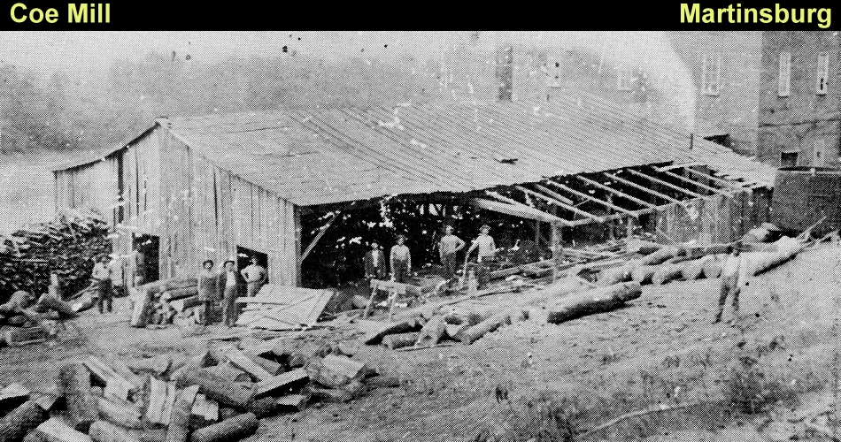
Agriculture remained the primary source of income for whites as well. Between 1860 and 1880 Monroe County farms ranged from 50 to 500 acres with the average size around 150 acres. By 1900 between twenty five and fifty percent of land in the county had been cleared for agricultural products. At this time the county was home to 2,236 farms, 64 of which were owned by black farmers and the remaining 2,172 were white owned. These farms collectively produced between $1,000 and $2,500 of agricultural products annually. Farms still depended heavily on steamboats for transportation to ship products to market. The railroad boom of the late 19th century had bypassed Monroe County and surrounding counties. Geographically the surrounding rugged terrain and strong economic attachment to river transportation discouraged railroad companies. Steamboats remained the dominant transportation method in the region until the 1920s with the emergence of automobile travel and the trucking industry. Bypassed by the railroads and having a sufficient, but not exceptionally lucrative, agricultural economic base, Monroe County remained largely rural in character by the close of the 19th century. Towns and communities scattered throughout the county held steady with small populations and little industrial development. In 1890 both Tompkinsville and Fountain Run had 350 residents, and Martinsburg had 151. Demand for sawn lumber grew with the exploitation of the county’s timber resources. Numerous sawmills were built throughout the county, especially near the Cumberland River where log rafts were created for transport downriver.
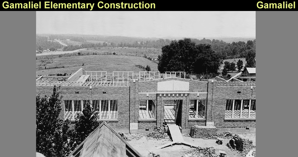
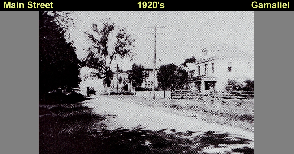
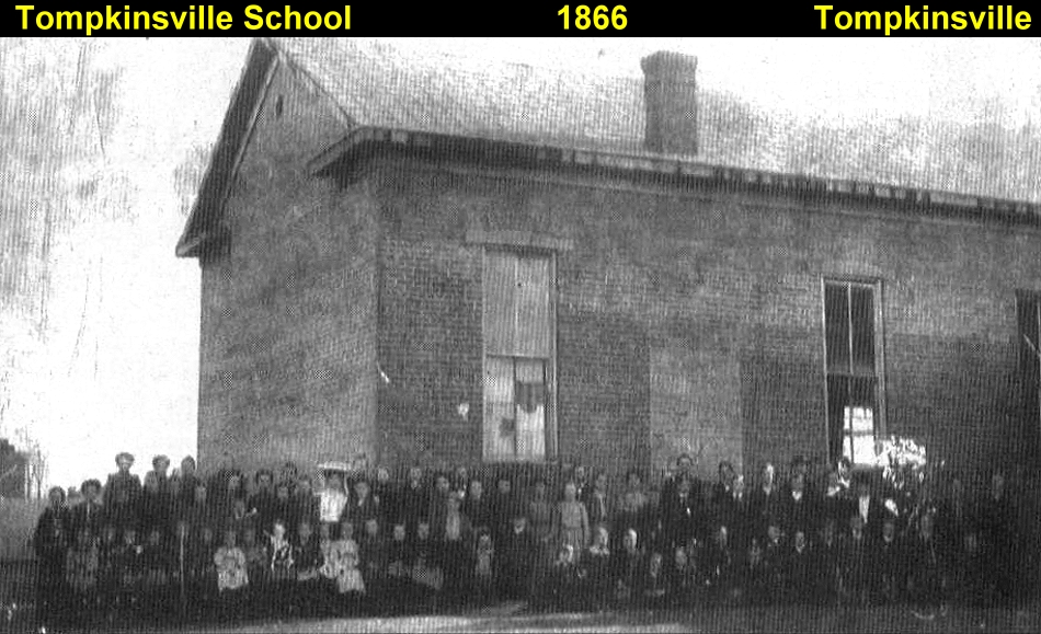
As the population gradually rose schools became an increasing concern. Schools had been around as early as the 1790s with lessons being administered in the Old Mulkey Church. By 1850 twenty-six schools for white students existed in the county, and in 1870 nearly 2,000 white and 24 black students attended Monroe schools. To accommodate the rural population, which was widely spread throughout, communities erected several one-room schools at around 1900. By 1920 Monroe County had 46 white schools and 9 black schools. In 1934 the total number schools reached 61and included four high schools, those at Tompkinsville, Gamaliel, Fountain Run, and Flippin. During the 1930s the Works Progress Administration (WPA) had its hand in building various Monroe County school buildings. Many of the one-room county schools remained in use until the 1950s when a move to consolidate the schools resulted in the construction of a series of larger, modern facilities. Although largely abandoned a reconnaissance level survey in 2000 identified over a dozen of these frame one-room school buildings of the early 20th century still standing in Monroe County. In the early 20th century several one and two room schools were constructed throughout the county to serve the children of its residents. These were typically one-story, frame, gable end buildings with weatherboard siding and four-over-four wood sash windows. A common feature of the schools was a central projecting gable bay, which contained the main entrance. Many of these schools remained in use until the 1950s. The 1983 survey inventoried over a dozen of these schools, however since that time many of these buildings have been razed or are now in ruins. At least two schools retain integrity of construction and design from this period; the Flippin School built in 1938 at Flippin and the Hickory Ridge School built in 1920 on Hickory Ridge Road.
Churches have been an important part of Monroe County’s heritage, and a number of small community churches were constructed throughout the county in the 19th and early 20th century. These are primarily modest frame gable front structures. Many of these churches still hold religious services, and several examples are documented in the 1983 survey. Many of these have been altered though the addition of synthetic siding materials, replacement doors and windows, or added wings. However, there are examples of churches that retain their original materials and architectural integrity. One example is the Corinth Church. Built in1902 this frame gable front church retains its original weatherboard, four-over-four wood sash windows, and interior chamfered support columns as well as wood floors, walls, and ceilings. Other churches retaining much of their original design and detailing include the Fountain Run General Baptist Church, a vacant church east of Fountain Run, the Lebanon Church of Christ, the Liberty Methodist Church , the Berea Church, and the Vernon Church (MR-237).
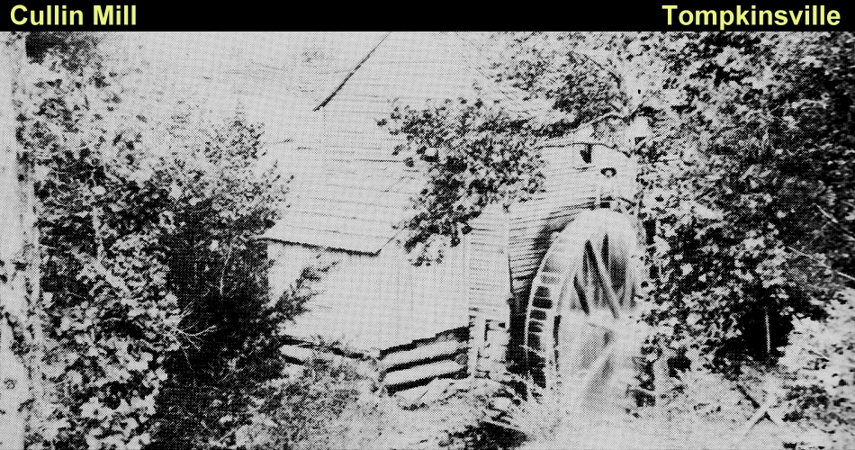
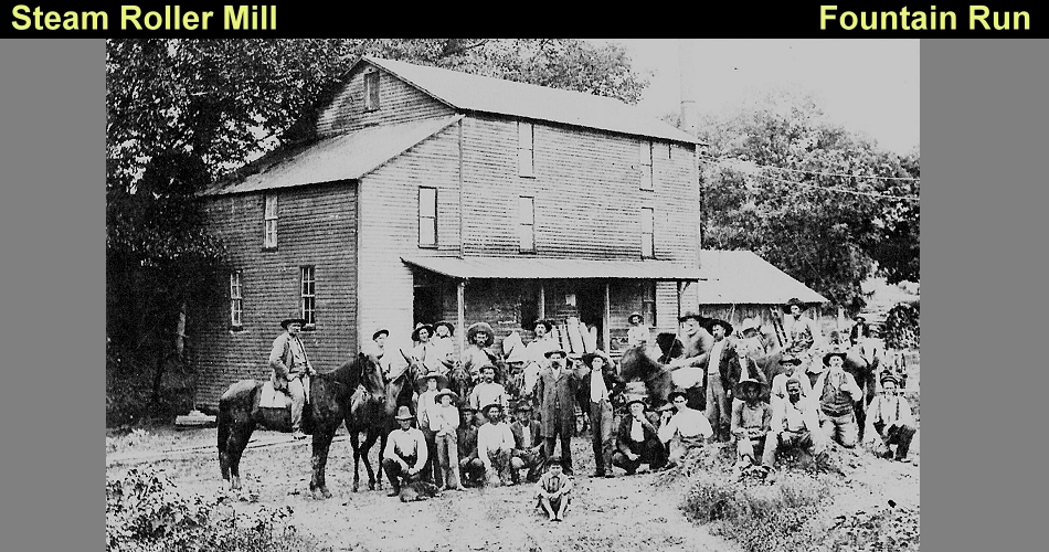
In the early 20th century Monroe County began to experience a small amount of industrial growth although the county’s economy continued to remain reliant on agriculture. Sawmills remained a strong business with mills located throughout the county. Some of the more prominent mills in the 1920s were the McClendon Brothers, Monroe Stave Co, and Casey Singletree Co. A few small industries emerged near Tompkinsville in the early 20th century. WD White Jr established an ax handle factory in 1916 and in the 1940s a casket factory and a smoke pipe factory came to the area. These industries never grew to a substantial size and had little economic impact on the county. Few historic industrial buildings remain intact in a Monroe County and only small industries were located in the county in the early history. Grain mills were perhaps the most common industrial buildings of the 19th century and many remained in use well into the 20th century. However advancements in the late 20th century have resulted in the disuse of these buildings, with many razed or abandoned. Moore’s Mill which was located on Route 163 just west of the community of Hestand was an excellent example of an early industrial building. However it has been razed since 1983. Burnett’s Feed Mill in Fountain Run remains standing however it suffers from neglect and deterioration.
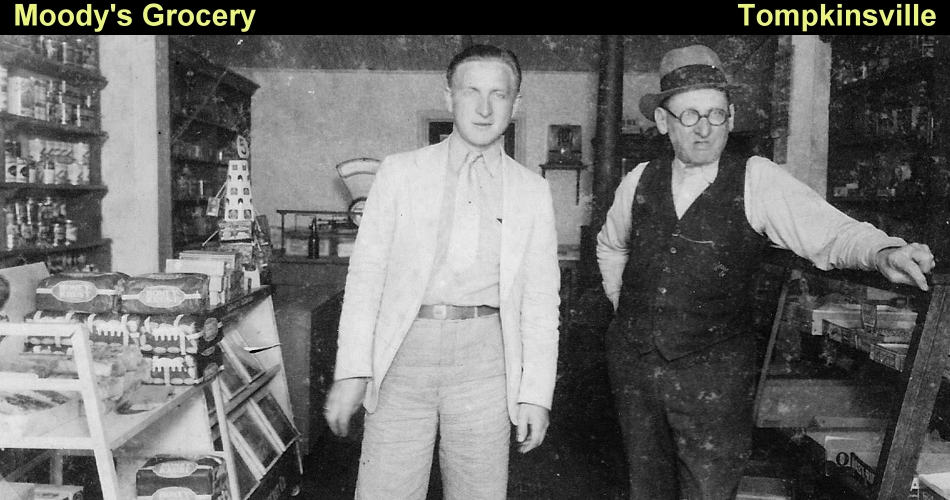
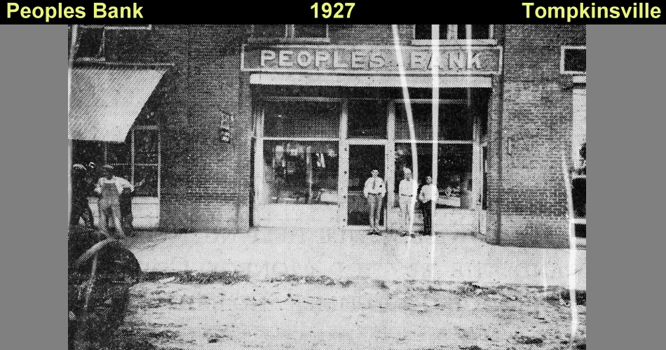
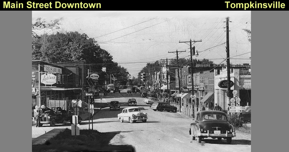
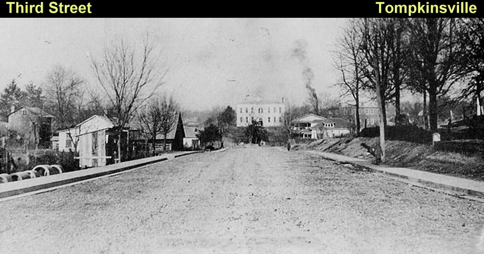
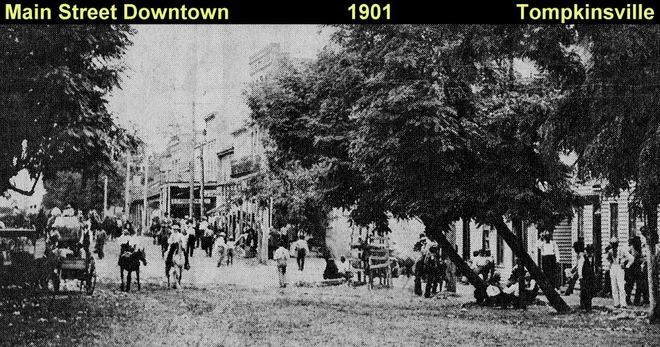
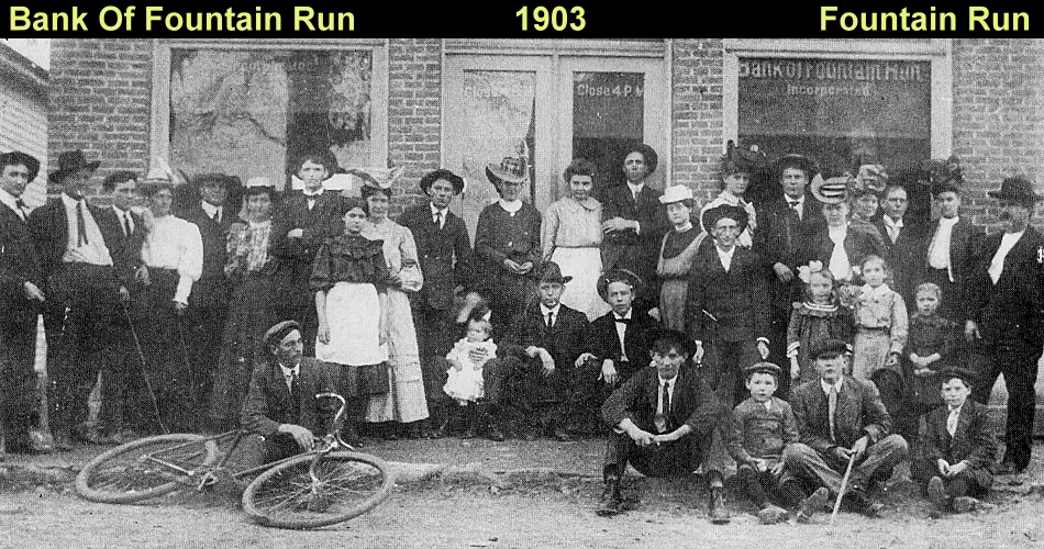
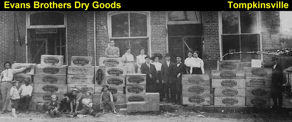
In the 1920s and 1930s many of the county’s gravel and dirt roads were paved which improved vehicular access throughout the county. These improvements to the county’s road system came at the expense of the steamboat trade. The rise in the trucking industry hastened the decline of the steamboat traffic on the Cumberland and activity at the river landings of Black’s Ferry and Martinsburg greatly decreased. These decades also witnessed the construction of major federal highways through central Kentucky such as US 31W, US 31E and US 127. Residents hoped that one of these highways would run through the county but these roads along with their associated economic benefits, ended up elsewhere. By the end of the 19th century, Monroe County continued to be largely rural in character with only a few sizeable communities. In addition to the county seat of Tompkinsville other significant communities included Gamaliel, Fountain Run, Flippin, Martinsburg, and Hestand. At their height these communities boasted populations of less than 200. Several other smaller crossroads communities such as Gum Tree and Meshack consisted of 30 residents, one or two stores, and sometimes a feed mill or blacksmith shop. Pre-1910 commercial buildings are primarily found in Tompkinsville or the other small towns which were centers for trade in the 19th century. They housed banks, general merchandise stores, grocery markets, and other enterprises. These buildings are typically one-story in height and are of brick or frame construction. Common details include a parapeted roofline, corbelled brick cornices, and recessed storefront entries. Several intact examples of 19th and 20th century commercial buildings remain extant in Monroe County. Properties surveyed in 1983 eligible for the National Register include the Bailey Howe Grocery at Fountain Run, a commercial building in downtown Fountain Run, and the Baxter Brothers Store and Hestand Post Office at Hestand. Other eligible commercial buildings include the Gamaliel Bank built in 1903 at Gamaliel and the Tompkinsville Service Station built in 1930 at Third and Main Streets in Tompkinsville.
Agriculture remained the major source of income for Monroe Countians into the 20th century. Throughout the early 20th century various agencies established in the county to provide advancement in agricultural activities. In 1928 the County Extension Office was established. This office introduced and encouraged the use of scientific methods. The Agriculture Stabilization and Conservation Service was established in 1933, and in the 1940s, the Monroe County Farm Bureau was founded and the Soil Conservation Service was organized. The latter agency controlled erosion and established watershed projects and farm ponds. The Cudahy Cheese Manufacturing Company opened in Tompkinsville in 1949. Its presence led to a significant increase in the county’s dairy farms and in cheese production. The Dairymen later acquired the company and the plant was in operation until 1983. Farmsteads are another property type inventoried in the county. These properties possess original dwellings along with numerous original domestic and farm outbuildings. Such properties may be eligible under National Register criterion A for their significance in demonstrating agricultural practices of the 19th and early 20th centuries. Potentially eligible properties include the Vanus Hayes Farm, and the Robert Pedigo Farm.
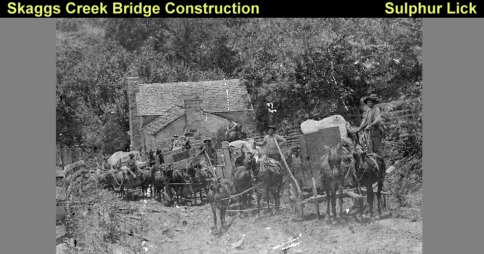
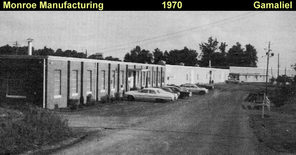
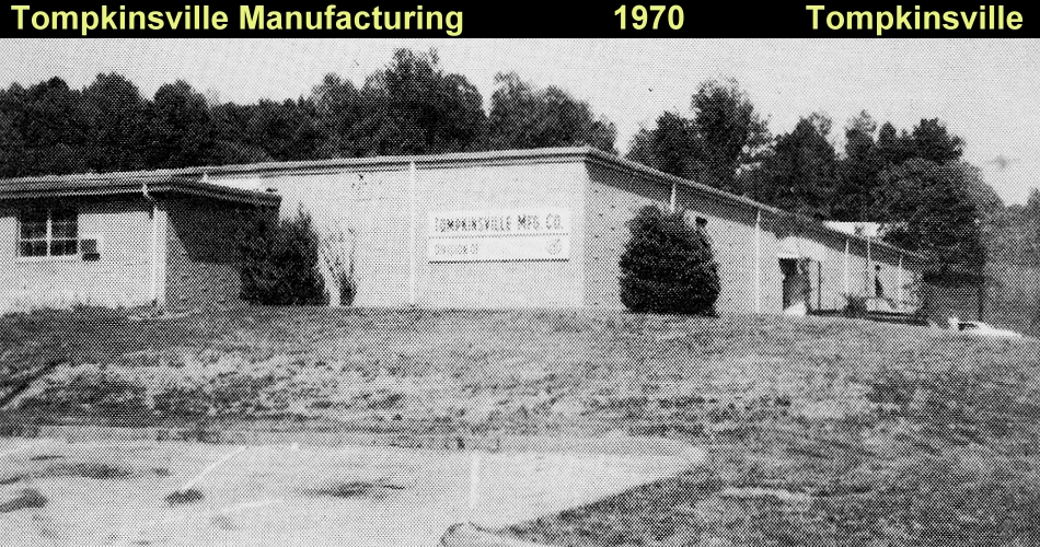
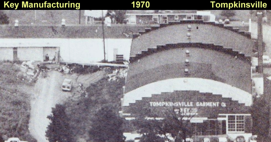
One of the more substantial developments in Monroe County in the 20th century was the discovery of oil on various farms. Oil first appeared in the Kettle Creek area east of the Cumberland River and near Sand Lick in the 1920s. Companies quickly sought mineral and land rights and sporadic drilling took place but no major oil supplies were identified. The fever for "black gold" surfaced again around 1950. This time oil had been located in the Meredith and McFarland Creek areas near Hestand and Vernon. Although drilling in these areas proved more successful they too eventually proved to be insignificant. The largest Monroe County oil strike happened in Late November of 1965. A "gusher" was established on the Jack Hayes Farm along the banks of Skaggs Creek in the Sulphur Lick community. The well’s pressure produced over 7,000 barrels a day and oilmen from Texas and Florida rushed to buy land in the area. Landowners were paid from $2 to $100 an acre for oil leases resulting in over $700,000 paid to Monroe County property owners. By mid-December over 60,000 barrels of oil had been taken from Sulphur Lick wells. However in a few weeks the pressure diminished and the promise of a lucrative oil industry in the county again vanished. More industrial growth happened in the 1960s although it still remained limited. In 1969, the county contained twelve manufacturing firms which employed approximately 1,080 people. Sixty-four percent of this total were women. The largest manufacturers were in the apparel industry. The Monroe Manufacturing Company in Gamaliel produced slacks and employed over 300; the Key Manufacturing Company in Tompkinsville made jeans and had 200 employees; and the Tompkinsville Manufacturing Company makers of pants employed over 250 persons. Other industries included lumber, fertilizer, concrete, printing, and cabinet manufacturers. Today Monroe County remains largely rural in character with agriculture continuing to be the primary occupation. Small communities are scattered throughout the county, and Tompkinsville remains the area’s largest town with a population of approximately 4,000 residents.

 CLICK BELOW!


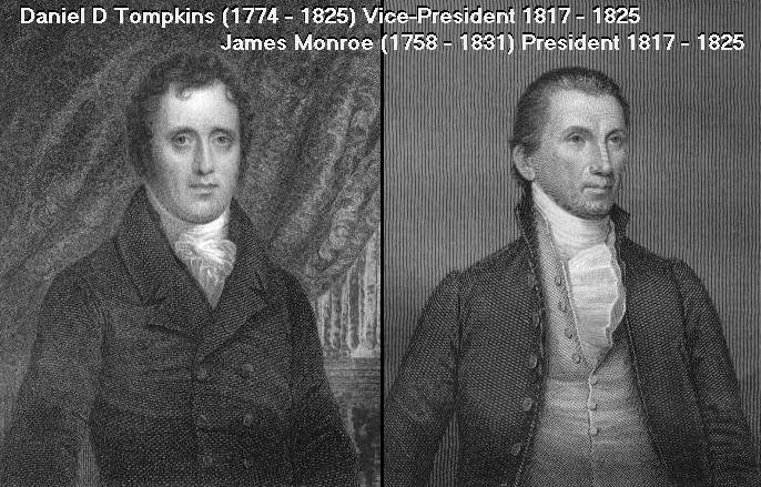
By 1790 this was the second largest community in the area with Glasgow being the largest. In 1809 JC Watson built the first store here and the community became known as Watson's Store. When Watson's Store was incorporated in 1817 it was given the name Tompkinsville, in honor of Daniel D. Tompkins, current Vice-President of the United States. The county was carved from parts of Barren and Cumberland counties on January 19, 1820 and named for the current United States President, James Monroe. Tompkinsville won a hotly contested election to become the county seat of Monroe County. In doing so, Monroe County became the only county in the United States named for a President where the county seat is named for the Vice-President.


Website created and maintained by George Stewart/Rainman Graphix ©1998-2025
Send your comments or questions to webmaster@georgestewart.online